Thermal Drone Survey
You entered a video URL that isn't compatible with this shortcode.
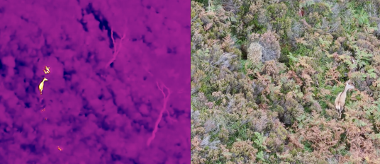
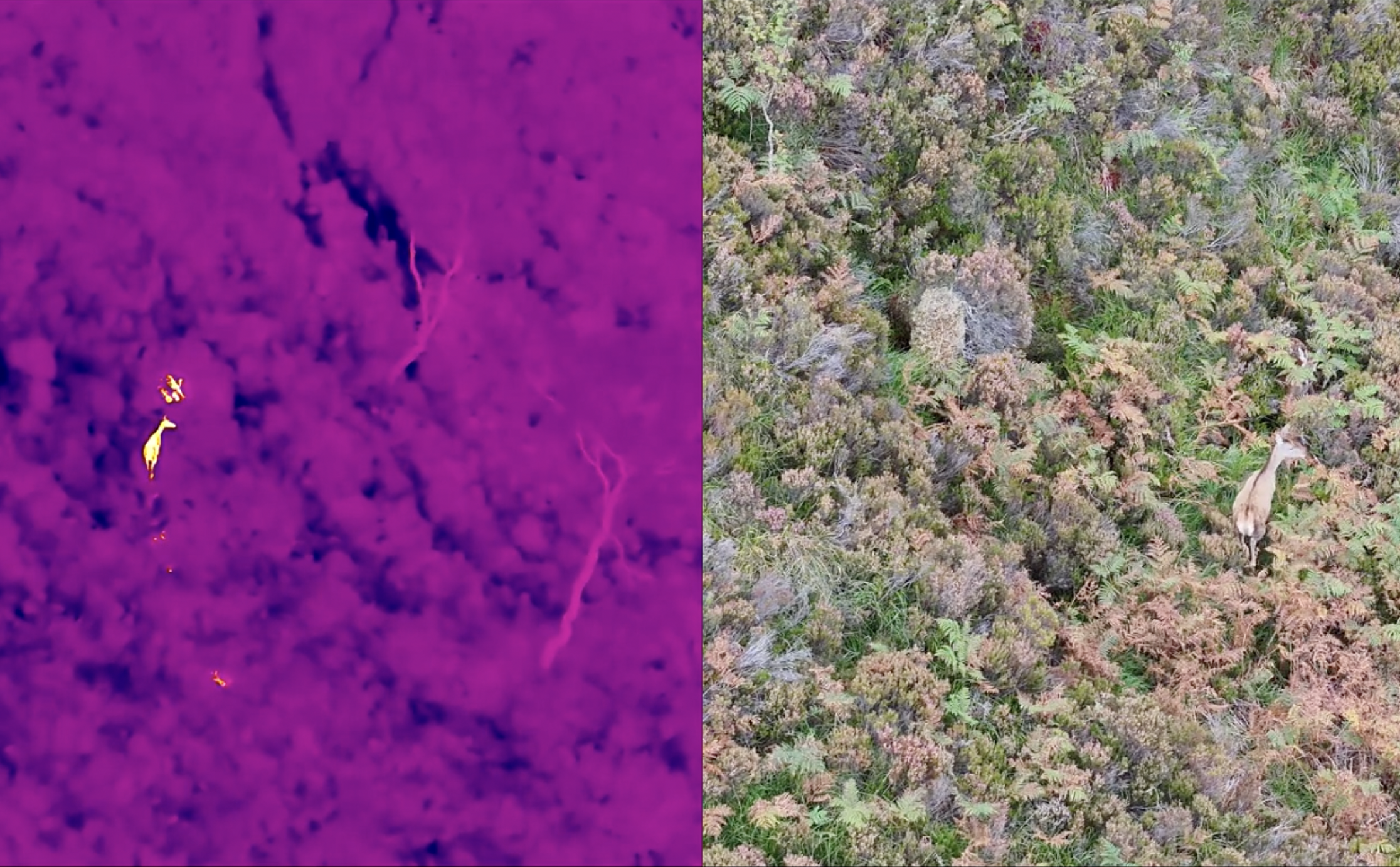
We’re excited to introduce our new thermal drone survey service, a cutting-edge solution for efficient and non-intrusive land management. Our state-of-the-art thermal drone can quickly and accurately survey large areas, detecting the heat signatures of wildlife such as red deer. This technology is ideal for rapid population counts and for locating animals in challenging terrain or dense foliage. By providing accurate data, our thermal drone surveys help you protect valuable assets, such as newly planted trees, and support informed wildlife management decisions with minimal disturbance to the environment.
Key Advantages of Our Thermal Surveys
- Increased Accuracy: Detects animals that are hidden by dense foliage or in low-light conditions, providing a more reliable population count.
- Time and Cost Efficiency: Surveys large areas in a fraction of the time required for traditional ground-based methods.
- Minimal Disturbance: Gathers data from a safe altitude, ensuring a low-impact approach that doesn’t stress the wildlife.
- Actionable Data: Provides precise, geolocated information that is crucial for effective land management and asset protection.
 .
.